About
CHESTNUT HILL
"Spreading out at downtown’s Southern borders, this historically stocked neighborhood is seeing what looks like a resurgence – and with no surprise. From your backyard, you can see the city skyline towering above the rows of classic Victorians, quaint farmhouses, and newer developments that line the sidewalked streets of this urban neighborhood.
Walkability in the area is obvious. Downtown is a short hike North and the popular 8th South and 12 South districts are a short bike ride or 2 minute car trip. You’re also at the intersection of the city’s largest interstates making getaways out of town even faster.
Handymen and skilled DIYers will love the area’s many opportunities to turn a crumbling artifact into a historic masterpiece, but completed renovations, condos, and new builds are also on the menu – and still at a price that won’t last long."
- The neighborhood as described by Nashville And Beyond
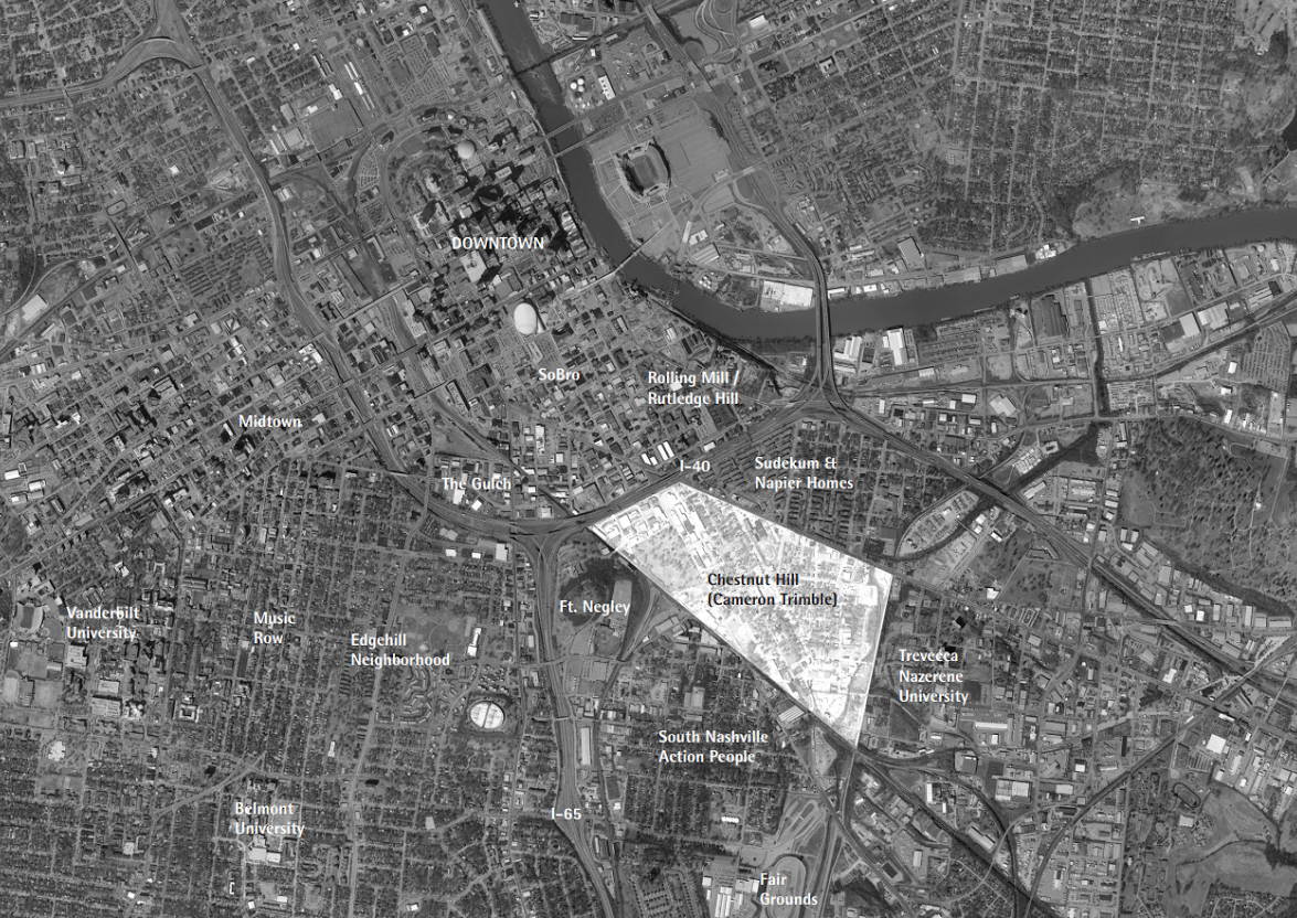
Chestnut Hill is an irregular polygon bordered by Lafayette Street/Murfreesboro Pike on the Northeast, I-40 to the North, and CSX lines on the Southeast and East. The eastern edge of Chestnut Hill is also adjacent to Trevecca Nazarene University.
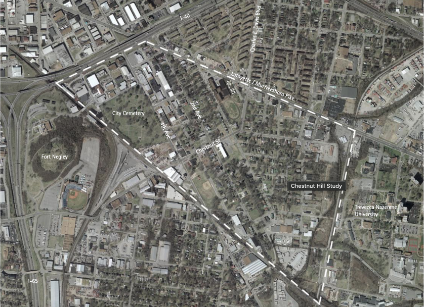
Chestnut Hill is wholly included in Census Tract 160, Davidson County, which also includes Napier. Chestnut Hill is 320 acres of land in Nashville.
Public websites are not sources of truth for historic neighborhood boundaries. For example, when comparing results for Nextdoor versus Google Maps, there are differences representing as much as 30% of the neighborhood.
The neighborhood has an association by the name of Trimble Action Group (TAG). The name of the association preserves the historical name of the neighborhood. TAG meets every other month at local restaurants and businesses. To learn more about TAG and how to get involved, sign up for our email list! You can find contact information for TAG's officers at the following link.
The History of TAG
As excerpted from the Civic Design Center's 2005 Report: In 1997 Trimble Action Group (TAG) was formed as a method of giving residents a voice to express their concerns and a method for taking action. TAG has: Fought zoning changes that would threaten the nature of the residential neighborhood; Completed “neighborhood audits” that focused the attention of Metro Codes and other city departments on neighborhood conditions; Worked with the Metro Planning Department and the Nashville Civic Design Center to develop a “neighborhood plan” and an even more concrete vision for the neighborhood; Partnered with the Metro Development and Housing Agency in planning for the use of $500,000 in federal community development funds in the area. TAG is continuing to fight for the redevelopment of its area, especially in preserving existing housing and in encouraging single-family homes to be built on the many vacant lots in the neighborhood. With the recent redevelopments in other urban neighborhoods in Nashville, hopes are high that this area could be one of the next neighborhoods to experience growth. In 2005, residents voted to change the name of the neighborhood to Chestnut Hill, symbolizing their belief in its rebirth.
If you drive north on Second Ave S from the Fairgrounds, you will cross under a railroad bridge which has artwork representing the neighborhood.


District 17 is represented by Terry Vo (Metro Site; Terry's Site) since 2015. Terry publishes a monthly blog, which you can also get delivered as an email newsletter. To sign up for the email newsletters, enter your email address in the top left corner of the page (subscribe button).
To the West (across Interstate 65) is Edgehill.
To the North (across Interstate 40) is a neighborhood with several names. Most commonly, this area is called SoBro (for South of Broadway). Within SoBro, you will also find Pie Town (in the pie-shaped triangle between 8th Ave S, Lafayette Street, and Interstate 40) and Rolling Mill Hill. To the Northeast are the Sudukum and Napier Place communities managed by MDHA, as well as other residential homes, parks, and an elementary school.
To the Southeast is Trevecca Nazarene University, a private Christian liberal arts college founded in 1901.
About This Site
The intent of this site is to chronicle the unique history of this neighborhood, aggregate information about the current state of the neighborhood, and help to grow the community of the neighborhood. If you have information to contribute to this website, please contact chestnuthillnashville@gmail.com. The site was built by: